

Structural Intelligence · Infrastructure analytics
Spot your asset vulnerabilities
before they become failures.
Asset integrity management powered by patented computer vision technology for asset condition, hazard exposure, and vulnerability analysis designed and validated by civil engineers in accordance with established engineering standards. Built with the U.S. Air Force; deployed across buildings, roads, and runways for civilian and military assets.

two ways to access
AI-driven infrastructure integrity intelligence, however your team works.
Receive condition, hazard, and damageability deliverables back through custom reports, the API, or MCP.
Asset Reports
Inspectable, mappable condition + risk deliverables per asset. Surface, roof, runway, road. Built for engineers, portfolio and program managers.
dashboard.atheniumanalytics.com
API
Receive condition ratings, hazard scores, and replacement cost values into your asset-management database.
api.atheniumanalytics.com/property/v3/property/address
MCP
Let your AI agent ask what the runway condition looks like, where the worst pavement is, or which buildings are most at-risk this year.
https://mcp.barocline.com/mcp
Interactive: distress detection
From imagery to a prioritized repair plan in one pass.
Athenium's computer vision ingests high-resolution imagery from fixed-wing aircraft, satellites, and drones. Below: a sample road-network inspection — toggle between today's condition rating and the forecasted damage risk over the same map.
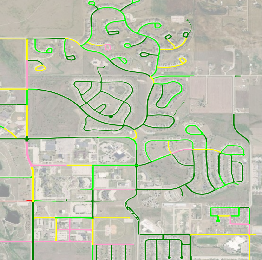
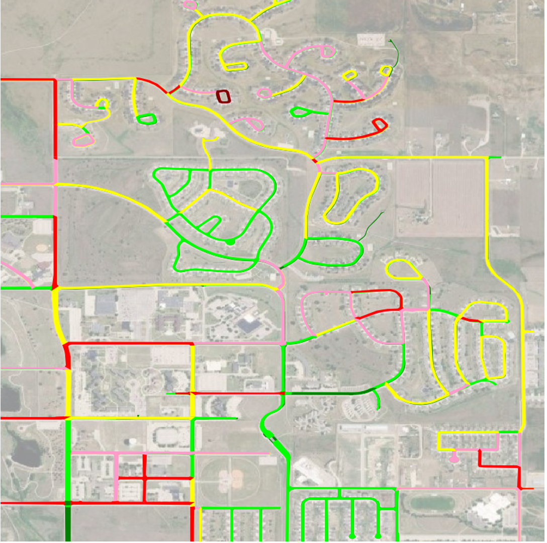
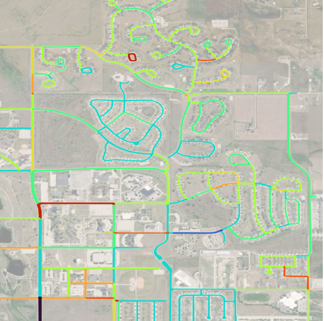
Pavement Condition Index (PCI)
Forecast deterioration combining current condition, hazard exposure, traffic load, and material age. Each score maps to the projected time until the asset reaches Very Poor condition.
What Structural Intelligence delivers
Automated, AI-driven assessments at the scale of a full asset network.
Three product lines. Asset identification, hazard assessment, and predictive damage risk. Wired together so a civil engineer, program manager, or mission lead can act on one ranked list.
Computer-vision asset assessment
Ingest high-resolution imagery from fixed-wing aircraft, satellites, and drones; classify roof, runway, and roadway distresses automatically.
Hazard exposure scoring
High-resolution risk scoring quantifies potential impacts to operations, infrastructure, materiel, readiness, and performance from severe natural hazards.
Predictive damage risk
Forecast future infrastructure degradation, damage, and associated repair costs targeting maintenance dollars where they matter most.
Change-detection reports
Track roadway and asset deterioration over time with successive inspection passes; identify accelerating-decay zones automatically.
Landing-strip identification
Upload imagery of any location to automatically identify paved surfaces suitable for aircraft landings tailored to mission and aircraft type.
Asset-database integration
End-users integrate condition, hazard, and damage risk insights directly into existing asset-management systems with no custom glue.
After the event
Post-event damage analysis, scored per asset.
Property-level post-event damage ratios. Used by carriers and public agencies to validate claims and pre-stage repair crews across hurricane, hail, tornado, flood, and wildfire events.
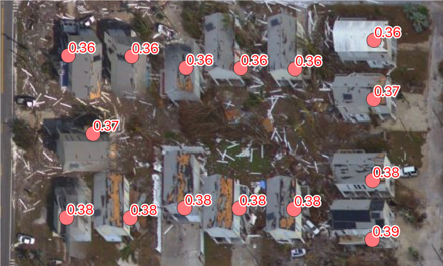
Wind- and surge-driven roof and façade loss scored from aerial and satellite imagery within 24–72 hours of landfall.
Roof and skylight damage detected from high-resolution flyovers — bridges loss-cost models with verified imagery evidence.
Path-aligned damage assessment for narrow but intense corridors; identifies destroyed vs. partially damaged structures.
Post-event inundation extent and depth fused with asset elevation to score water-damage exposure per building.
Burn-scar overlap and thermal imagery distinguish destroyed, damaged, and intact structures within the perimeter.
Built with the U.S. Air Force
Infrastructure assessments at the scale of a service branch.
Athenium partners with the U.S. Air Force to deliver infrastructure condition and damage-risk assessments across both on-base assets and asset transportation networks. Users depend on these analytics to plan operations more safely and effectively.
Capability at a glance
Decisions on infrastructure that hold up at audit.
PCI
Industry-standard risk index
100 %
Coverage across the contiguous U.S.
AI
Automated, patented analysis. Engineering teams stay in the driver's seat
USAF
Single source of truth across mission stakeholders
get started
See Structural Intelligence on your portfolio.
30-minute working session: bring a sample of locations or a recent event, and
we'll run it live. No deck.